 vesseltracker.com
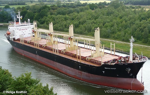
Vessel Peace M IMO: 9086318, MMSI: 511100750 Bulk Carrier
UTC, 34.93369, 35.83335, course: 215, speed: 0
UTC, 34.93340, 35.83364, course: 220, speed: 0.1
2026-01-31 17:21:46 UTC, 34.93340, 35.83364, course: 220, speed: 0.1
Live AIS position:
UTC. Near Tartous),
updated 2026-01-31 17:21:46 UTC.
Find the position of the vessel Peace M on the map. The latter are known coordinates and path.
marine traffic ship tracker show on live map
The current position of vessel Peace M is 34.93340 lat / 35.83364 lng. Updated: 2026-01-31 17:21:46 UTCCurrently sailing under the flag of Palau
Peace M built in 1996 year
Deadweight:
0 tDetails:
Last coordinates of the vessel:
UTC, 34.93356, 35.83364, course: 219, speed: 0.2UTC, 34.93369, 35.83335, course: 215, speed: 0
UTC, 34.93340, 35.83364, course: 220, speed: 0.1
2026-01-31 17:21:46 UTC, 34.93340, 35.83364, course: 220, speed: 0.1